ARTIST: Philippe Vandermaelen
PUBLISHER: Published by P. Vandermaelen, Belgium.
MEDIUM: Lithograph handcolored,
DATE: 1827
EDITION SIZE: Image size 18 3/8 x 22" (468 x 560 mm) plus margins.
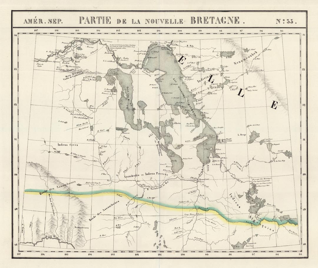
DESCRIPTION: A beautiful map of south central Canada focusing on current day Manitoba Province and northern portion of North Dakota and Northwestern Minnesota. Fort Garry (current day Winnipeg) is noted at the confluence of the Red and Assiniboine Rivers. Lakes Winnipeg and Manitoba are also prominently shown. The yellow and green line shows the not yet set and meandering border between the United States and Canada. Plate No. 33 from "Atlas Universelle” The first commercial atlas printed using lithography as the printing medium.
ADDITIONAL INFO:
CONDITION: Very good condition. Original color.
REFERENCE:


 Login / Register
 Basket