Price: $350.00
SKU: 86635
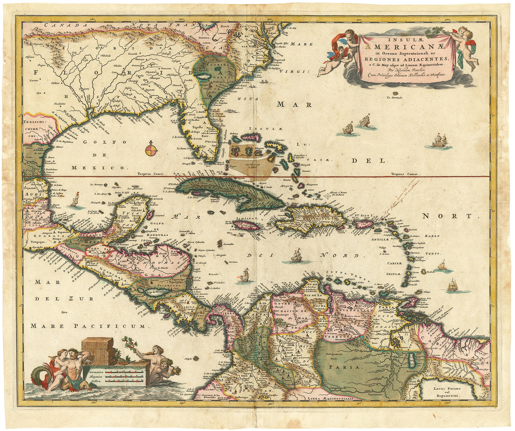
ARTIST: Nicolaes Visscher
MEDIUM: Copper plate engraving
DATE: c.1670.
EDITION SIZE: Image size 173/4 x 21 5/8" (45 x 54.9 cm) plus margins.
DESCRIPTION: A beautifully engraved map of Denmark, the northern tip of Germany and southern tip of Sweden. The elaborate title cartouche is held aloft by two putti below which is a royal crest of arms flanked by two men with livestock in the background. In the sea are many styles of sailing vessels In the upper left is the royal crest of King Frederik III.
ADDITIONAL INFO: A vibrant impression.
CONDITION: Good condition save for some repaired splitting along the lower centerfold. Black & white.
REFERENCE:


 Login / Register
 Basket