Price: $450.00
SKU: 88256
ARTIST: J. Young
PUBLISHER: Published in Nuremberg by Freidrich Campe.
MEDIUM: Lithograph,
DATE: c.1840.
EDITION SIZE: Image size 16 5/8 x 21 1/2" (42.3 x 54.6 cm) plus margins.
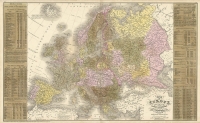
DESCRIPTION: This rare and unusual German edition of Mitchell’s Travellers Guide through the United States is a fascinating example of early cartographic piracy. Originally published by J.H. Young and S.A. Mitchell in 1832, the American version was immensely popular and issued for over three decades. The German publisher Friedrich Campe closely copied the map and added German-language titles for a European audience. Insets include detailed city plans of Charleston, Washington–Baltimore, Philadelphia, Boston, New York, Niagara Falls, Albany, Cincinnati, and New Orleans, making it a highly practical and attractive map for German-speaking travelers or emigrants. While the earliest German edition was dated 1837, this particular impression omits that date from the title cartouche and introduces new and significant cartographic content, especially in eastern Texas. The border between Texas and Louisiana is drawn incorrectly, following the Neches and Angelina Rivers before turning north toward Pecan Point on the Red River. Many Texas towns are newly added—including Houston, Washington, Beaumont, and Crockett—along with roads and two forts: Fort Houston and Parker’s Fort. These updates, combined with the removal of the publication date, suggest this is a previously undocumented state of Campe’s pirated map, offering a unique window into early German interest in the rapidly expanding American frontier.
ADDITIONAL INFO: This piece is in a 18 x 22.75 inch archival mylar for handling.
CONDITION: Good condition. Original outline color.
REFERENCE:


 Login / Register
 Basket