Price: $350.00
SKU: 88738
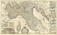
ARTIST: Hermann Moll
PUBLISHER: London sold by H. Moll over against Devereux Court between Temple Bar and St. Clements Church in ye Strand... .
MEDIUM: Engraving,
DATE: c.1735.
EDITION SIZE: Map size 23 3/4 x 39 3/8" (60.4 x 100 cm)
DESCRIPTION: Moll's large format map showing the "Austrian Netherlands" after the Peace of Utrecht in 1713. The map covers an area from Breda in the north to Amiens in the south. In the upper right is a detailed view of "a plan of all manner of works used in fortification. With the method of an attack."
ADDITIONAL INFO:
CONDITION: Fair condition, trimmed to neat line and some minor damages along the paper edge.
REFERENCE:


 Login / Register
 Basket