Price: $550.00
SKU: 8387
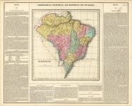
ARTIST: Fielding Lucas, Jr.
PUBLISHER: Published by H.C. Carey & I. Lea, Philadelphia.
MEDIUM: Handcolored engraving,
DATE: c.1822.
EDITION SIZE: Image size 16 11/16 x 20 7/16" (423 x 518 mm) including text, plus margins.
DESCRIPTION: A fine map from Carey and Lea's "A Complete Historical, Chronological, and Geographical American Atlas." Published in Philadelphia. The text describes the boundaries, climate, rivers, roads and canals, chief towns, and topography and soil. Drawn by F. Lucas Jr.
ADDITIONAL INFO: From the 1827 edition.
CONDITION: Good condition with original wash color save repair to lower centerfold.
REFERENCE:


 Login / Register
 Basket


![Geographical, Statistical, and Historical Map of the United Provinces of South America. [Argentina]](https://oldprintshop.com/uploads/2025/10/23531.jpg)