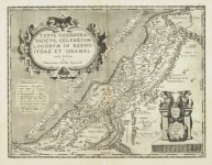
ARTIST: Abraham Ortelius
PUBLISHER: Published by Jan Baptist Vrients, Antwerp.
MEDIUM: Copper plate engraving,
DATE: 1584.
EDITION SIZE: Image size 14 3/8 x 18 7/16" (36.5 x 46.8 cm).
DESCRIPTION: The earliest European published map of China. Cartographically this map is based on the work of Jesuit priest Jorge de Barbuda, aka Ludovico Georgio whos manuscript map of China reached Ortelius by way of Arias Montanus. Oriented with north to the right, the map shows China, Indochina and parts of the Philippines and Japan. In the interior, several large lakes and the Great Wall appear. In addition to elaborate title and mileage cartouches, the map is adorned with Tartar tents, elephants and sail-driven carriages. <br><br>
ADDITIONAL INFO: An early printing. Latin text with page number 93 on verso.
CONDITION: Good condition. Nicely colored.
REFERENCE: Van den Brocke, M. "Ortelius Atlas Maps" #164. Koeman Ort 38 (119); Suarez (1999) "Early Mapping of South-East Asia".,


 Login / Register
 Basket