Price: SOLD
SKU: 98658
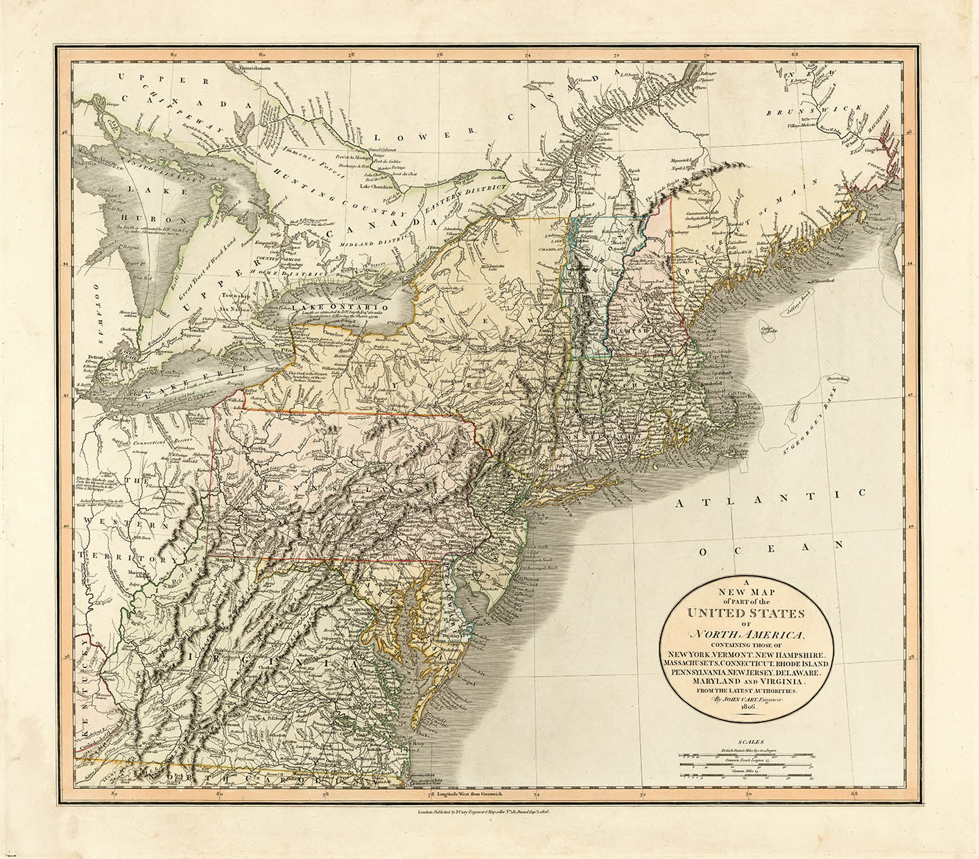
ARTIST: John Cary
PUBLISHER: London, Published by J. Cary, No. 86 St. James's St.
MEDIUM: Copper plate engraving
DATE: 1832
EDITION SIZE: Overall 49 1/4 x 38" (125 x 99 cm)
DESCRIPTION: Title continues with: Also The Market and Borough Towns and Villages adjoining the Road. By which is added the actual distance from one Market Town to another. With the exact measurement to each from the Metropolis. Drawn from the most Recent Surveys.<br><br> A large segmented case map that Carey advertised as "essential to the traveller." This map shows the entirety of the British Isles and Ireland. This maps was first issued in 1796 and was reissued with updates into the 1840's.<br><br> Hand colored, dissected, and backed unto linen when issued. Folds into 42 parts or segments. Marbled endpapers and complete with a green marbled slipcase to match that is labeled "Cary's two-sheet map of the United Kingdom." Published by G. and J. Cary.
ADDITIONAL INFO: Very original and untouched. Retains original slipcase.
CONDITION: Good condition, full original body coloring. Occasional minor stain or surface soiling.
REFERENCE:


 Login / Register
 Basket