Price: $125.00
SKU: 98849
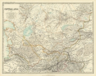
ARTIST: Keith Johnston
PUBLISHER: Published by W. & A. K. Johnston, Edinburgh & London.
MEDIUM: Multi-stone lithograph
DATE: 1897
EDITION SIZE: Image size 17 1/2 x 22 1/2" (44.5 x 57.3 cm).
DESCRIPTION: This detailed map of North America, published in Johnston's The Royal Atlas of Modern Geography, outlines the political borders of the United States, Canada, Mexico, Central America, and the Caribbean with precision and clarity. Oklahoma appears as a divided territory, with its eastern half labeled as Indian Territory, reflecting the political realities of the late 19th century. The map features crisp engraved lines and finely applied hand-coloring to distinguish national and territorial boundaries, giving it a refined and authoritative appearance typical of Johnston's cartographic style.
ADDITIONAL INFO: This piece is in a 20.25 x 25.50 inch archival mylar for handling.
CONDITION: Very good condition and color.
REFERENCE:


 Login / Register
 Basket