Price: $3,250.00
SKU: 100616
ARTIST: J. B. Beers
PUBLISHER: Published by J.B. Beers & Co. New York.
MEDIUM: Hand colored stone engraving,
DATE: 1886
EDITION SIZE: Image size 57 1/2 x 50" (146 x 127 cm)
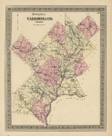
DESCRIPTION: A large scale, advertising map of Brooklyn and Queens, including all of today’s Nassau County.<br><br> This scarce map is highly detailed, drawn on a scale of 200 rods to the inch. Includes a reference key to Brooklyn City and an index key to the entire map. Also identified in the key are steam powered railroads and horse car lines. Surrounding the map are advertisements for local businesses and inset maps of various towns and villages including Coney Island, Rockaway Beach, Morris Park, Richmond Hill, Hollis, Long Island City, Sheepshead Bay, Cedarhurst, Sea Cliff and Lloyd’s Neck.<br><br> Identifies incorporated cities, towns (townships), numbered districts, roads, rural buildings, and identifies hundreds rural householders' names.<br><br> Overall a good example of a scarce map.
ADDITIONAL INFO:
CONDITION: Overall in good condition. Mounted on linen as issues, some splits along fold intersections. Original hand coloring.
REFERENCE:


 Login / Register
 Basket