Price: SOLD
SKU: 82681
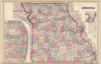
ARTIST: Ormando Gray
PUBLISHER: Published by Stedman, Brown & Lyon, Philadelphia.
MEDIUM: Stone engraving
DATE: 1873.
EDITION SIZE: Image size 11 7/8 x 14 7/8" (30.3 x 37.8 cm)
DESCRIPTION: A most interesting and detailed map of the Indian Territory, now known as Oklahoma. Noted are the lands allocated to various native American tribes. Many of the tribes are noted including the Cherokees, Cheyenne, Creeks, Choctaws, Chickasaw and Pottawattamies. This map does not include the panhandle, which at the time were public lands.
ADDITIONAL INFO:
CONDITION: Good condition save for overall time toning of the paper and faint damp staining. Original hand coloring.
REFERENCE:


 Login / Register
 Basket