Price: SOLD
SKU: 26018
ARTIST: Anthony Finley
PUBLISHER: Published by Anthony Finley, Philadelphia.
MEDIUM: Engravings,
DATE: 1833
EDITION SIZE: Quarto, 14 x 11 1/4" (358 x 285 mm).
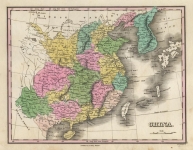
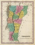
DESCRIPTION: Philadelphia: Anthony Finley, 1833. Folio. Engraved title and index leaves, printed table, 58 engraved handcolored maps and 2 engraved handcolored tables. [Bound with:] Atlas Classica; or Select Maps of Ancient Geography. Philadelphia: Anthony Finley, 1827. Folio. Printed title, 2 folding tables, 9 engraved handcolored maps (1 double-page), and engraved handcolored historical chart. Original marble paper covered boards with original label on inside front cover.
ADDITIONAL INFO: 1831 edition.
CONDITION: Leather over marbles boards. Some rubbing on binding. Original handcoloring. Overall, a nice example of this early American atlas.
REFERENCE:


 Login / Register
 Basket
 Atlas Classica; or Select Maps of Ancient Geography.")