Price: $750.00
SKU: 66724
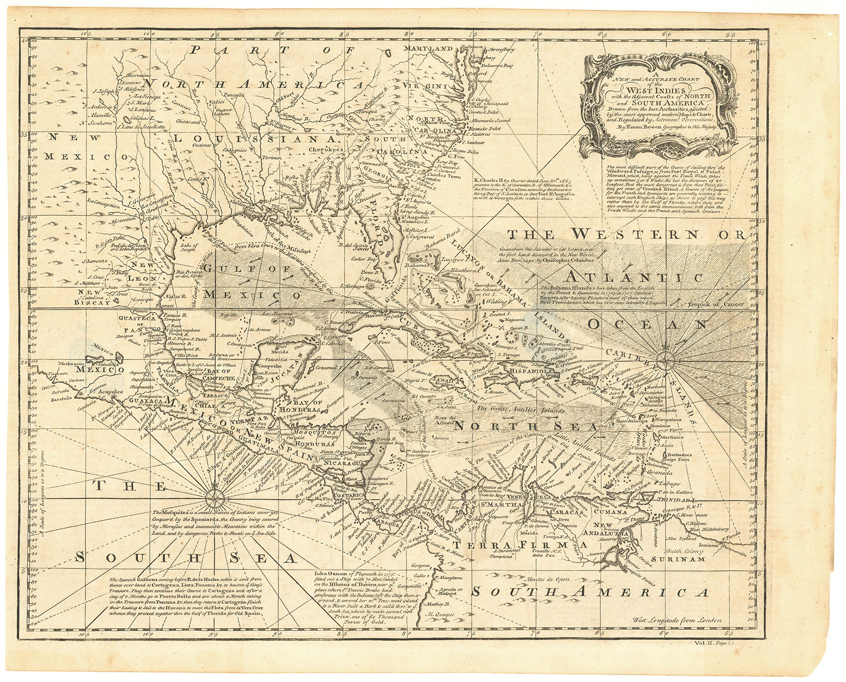
ARTIST: Emanuel Bowen
PUBLISHER: Published in Gentleman's Magazine, London, July 1754.
MEDIUM: Copper plate engraving,
DATE: 1754.
EDITION SIZE: Image size 8 7/8 x 10 7/8" (22 x 27.6 cm).
DESCRIPTION: Engraved by Thos. Bowen.<br><br> This is an important contemporary view of the British holdings in colonial America. The detail along the eastern seaboard is unusually extensive. In the "back Settlements" both French and English forts are located and, as Cumming notes, the location of Indian tribes west of the Blue Ridge is one of the best yet to appear. One notable error, however, is the siting of the junction of the Ohio and Mississippi Rivers, far south of its actual location.<br><br> A fine example of this map.<br><br>
ADDITIONAL INFO: Nicely framed in a18th century style receding black and sanded spandrel molding. Overall framed size 13.75 x 15.75 inches.
CONDITION: Very good condition.
REFERENCE: Cumming, SE, #272. Sellers & van Ee #708. Jolly, America in Periodicals, #47. McCorkle #754-1.


 Login / Register
 Basket