Price: $675.00
SKU: 61283
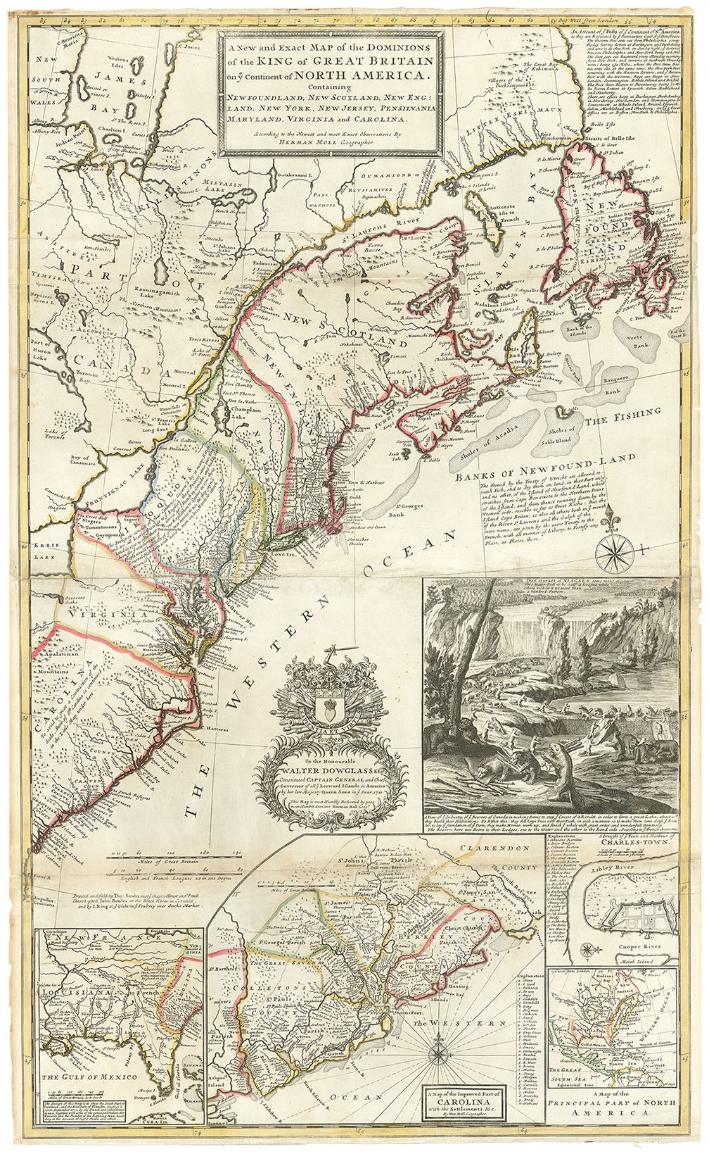
ARTIST: Hermann Moll
MEDIUM: Copper plate engraving,
DATE: c.1701.
EDITION SIZE: Image size 8 1/2 x 7" (21.5 x 17.7 cm).
DESCRIPTION: The title above the map: "The English Plantations on the Continent of Canada, viz. NEW-ENGLAND, NEW-JERSEY, NEW-YORK, PENNSYLVANIA, MARY-LAND, and VIRGINIA. Together with the Islands of Newfound-Land, the other Islands on the Coasts, and Bermudas."<br><br> An interesting early English produced map of the Colonies, extends from Davies Straits to Cuba. On the western portion of the English colonies is noted "The 5 Nations of the Iroquois."<br><br> This map appeared in "System of geography or A new & accurate description of the earth in all its empires kingdoms and states" One of Hermann Moll's earliest maps.
ADDITIONAL INFO: Framed in a 1" black ribbed molding with gilt inset mat. Overall framed size 17 x 14.25 inches.
CONDITION: Good condition. B/W.
REFERENCE: Cumming, Wm. "Southeast" #132.


 Login / Register
 Basket