Price: $975.00
SKU: 69485
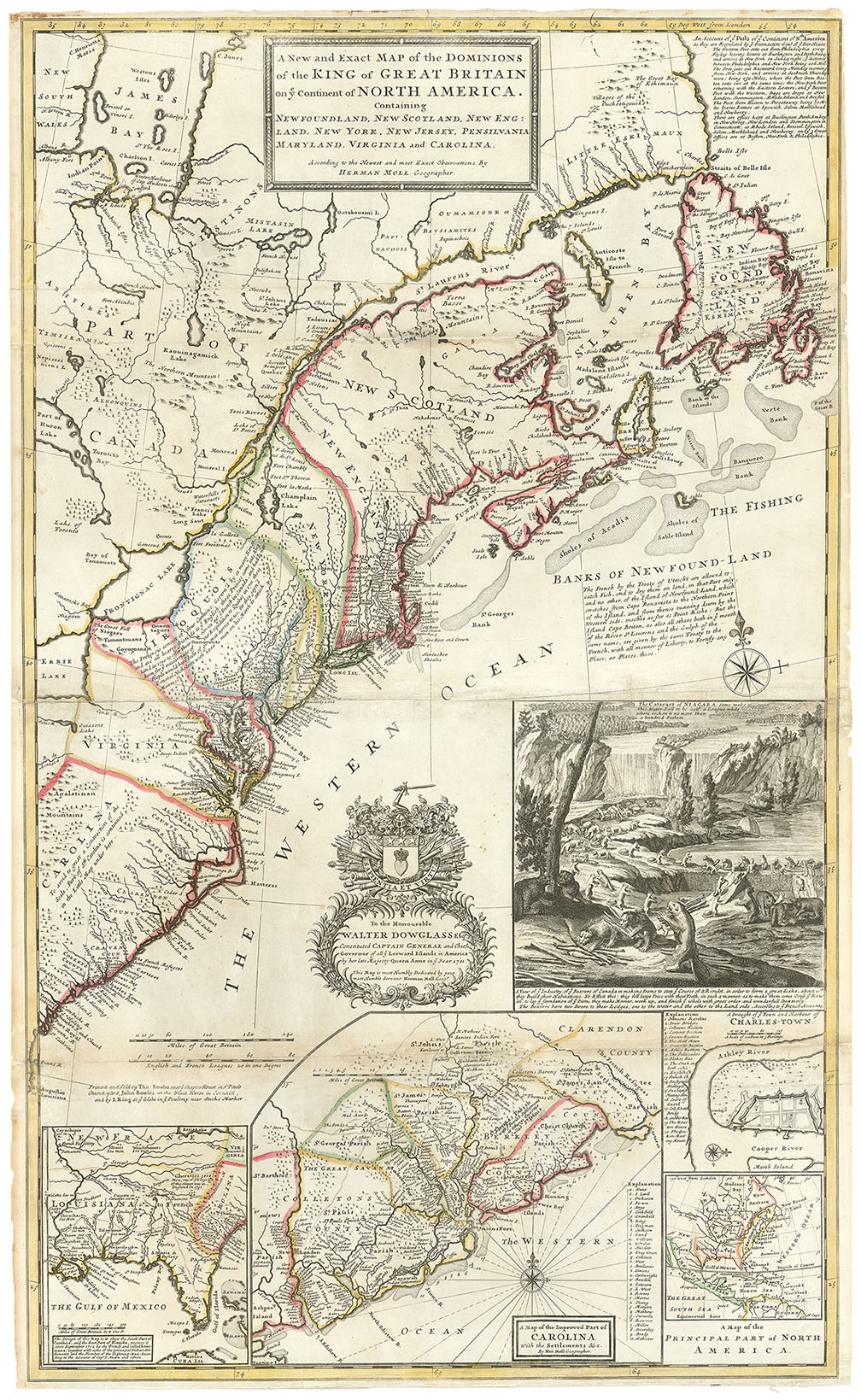
ARTIST: Hermann Moll
MEDIUM: Copper plate engraving,
DATE: 1729 (1739-55)
EDITION SIZE: Image size 7 7/8 x 10 1/2 " (19.9 x 26.8 cm)
DESCRIPTION: This is Hermann Moll's important "Post Map. Description in lower right: "Account of ye Post on ye Continent of Nth America as they are Regulated by ye Postmasters Genl. of ye Post House. The Western Post setts out from Philadelphia every Fryday leaving Letters at Burlington and Pert Amboy and arrives at New York on Sunday night; the distance between Philadelphia and New York being 106 Miles. The Post goes out Eastward every Monday morning from New York, and arrives at Seabrook Thursday noon; being 150 Miles, where the Post from Boston setts out at the same time; the New York Post returning with the Eastern Letters, and the Boston Post with the Western, Bags are dropt at New London, Stommington, Rhode Island, and Bristol... ".<br><br> Official postal service began in the New England colonies around 1639 when the Massachusetts General Court designated a Boston tavern as the official repository for mail arriving from or departing overseas. In 1673 official postal service between New York and Boston was introduced on a monthly basis but it was not until 1691, with the appointment of a Postmaster General to the colonies, that a centralized postal system evolved. The first post route in the Colonies, between New York and Boston, became known as the Boston Post Road and is today still in use as U.S. Route 1
ADDITIONAL INFO: According to McCorkle This is from the Dublin edition which appeared in "Modern History" with "EEE" in the lower right corner and 54 in the upper right corner.
CONDITION: Good condition. B/W.
REFERENCE: McCorkle, B. "New England in Early Printed Maps" #729.2


 Login / Register
 Basket