Price: $65.00
SKU: 104093
ARTIST: John Gibson
MEDIUM: Copper plate engraving.
DATE: 1769
EDITION SIZE: Image size 2 1/2 x 4 3/8" (6.3 x 11 cm)
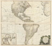
DESCRIPTION: J. Ginson Sculpt.<br> A numbered key identifies 18 buildings and prominent locations.<br><br> Louisbourg was settled by the French in 1714 with the fortress being built in 1720. During the French and Indian War this outpost on the Island of Cape Briton in Canada was identified as an important military target. British Admiral Boscawen along with Generals Amherst and Wolfe laid siege to the town and fort. The siege lasted six weeks and ended when M. de Drucourt, the French commander surrendered on July 26, 1758. This small map appeared in "The World Displayed" published in London 1769.
ADDITIONAL INFO: "1769" written in ink in lower margin.
CONDITION: Good condition. Trimmed tight on right. B/W
REFERENCE: Kershaw #391


 Login / Register
 Basket