Price: $200.00
SKU: 104667
ARTIST: George Anson
MEDIUM: Copper plate engraving
DATE: c. 1750.
SIZE: Image size 9 3/8 x 19 3/8" (23.8 x 49.4 cm)
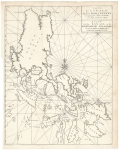
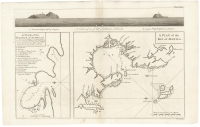
DESCRIPTION: This map appeared in one of the editions of Anson's A voyage round the world, in the years MDCCXL, I, II, III, IV, an account of his circumnavigation.<br><br> The Juan Fernandez Islands are a sparsely inhabited series of islands in the South Pacific Ocean, reliant on tourism and fishing. Situated 416 miles off the coast of Chile, they are composed of three main volcanic islands: Robinson Crusoe, Alejandro Selkirk, and Santa Clara.<br><br> The islands are primarily known for having been the home to the marooned sailor Alexander Selkirk for more than four years from 1704, which may have inspired English writer Daniel Defoe's Robinson Crusoe.<br><br> Commodore George Anson led a British naval squadron of eight ships around the world between 1740 and 1744 during the War of Jenkins' Ear. The mission aimed to attack Spanish possessions in the Pacific. It succeeded in capturing a rich Spanish treasure galleon, but suffered catastrophic losses from scurvy, storms, and shipwrecks, with only one ship and a small fraction of the crew surviving.<br><br>
ADDITIONAL INFO:
CONDITION: Good condition save for some repaired splitting along fold lines. B/W
REFERENCE:



 Login / Register
 Basket