Price: $850.00
SKU: 46963
ARTIST: Hermann Moll
PUBLISHER: H. Moll, London.
MEDIUM: Copper plate engraving,
DATE: 1711-17.
SIZE: 6 7/8 x 9 13/16" (174 x 249 mm) plus margins.
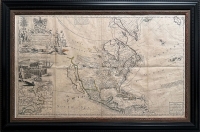
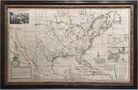
DESCRIPTION: By Herman Moll. From his Atlas Geographus, London, 1711-17. California appears as an island on the Sanson model; above it the Straits of Anian are sketchily outlined. The Great lakes all appear and the Mississippi River is correctly located. In the interior Lahontan’s mythical River Longue appears. The ancient eastern forests, later destroyed by advancing settlement, are clearly marked.
ADDITIONAL INFO:
CONDITION: Good condition.
REFERENCE: Phillips, Atlases, 557.



 Login / Register
 Basket