Price: $450.00
SKU: 105139
ARTIST: John Wood
MEDIUM: Engraving
DATE: 1824
SIZE: Image size 20 x 22 3/4" (50.8 x 57.9 cm)
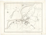
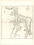
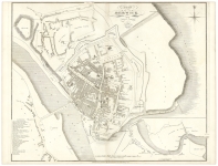
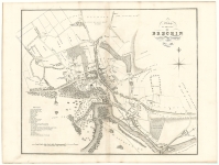
DESCRIPTION: A handsome and very detailed plan of the Scottish town of Hawick. A numbered key identifies 10 prominent public buildings and locations. Many homes are delineated with their owners’ names given. Engraved by T. Clerk.<br><br> Below is a portion of the descriptive account of the town from the text volume that accompanied the work:<br><br> <I> Hawick is a thriving Town, in the Parish of that name, and County of Roxburgh, on the great road from Edinburgh to London, by Carlisle. It lies 49 miles south of Edinburgh, 44 north of Carlisle, 20 west of Kelso, 10 west by north of Jedburgh, and 11 miles south of Selkirk. The Town stands chiefly upon the east bank of the river Tiviot, where the water of Slitridge falls into that river, and consists principally of the High Street, which runs nearly parallel to the Tiviot, about half a mile in length, with a large market-place at the south end of the Street. The other parts of the Town lie upon the south and west sides of the Slitridge, over which, there are two stone Bridges of communication one of which is very ancient ; over the Tiviot, a hand- some Bridge forms the communication with the country to the north. The High Street is broad, regular, and spacious, and contains many good and handsome buildings.<br> Hawick and its environs are the admiration of every stranger. The Banks of the Tiviot ate extremely picturesque and delightful, and the approach to the Town from the south, can nowhere be surpassed in beauty.</I><br><br> John Wood, 1780/85 - 1847, was a land surveyor from Edinburgh, Scotland and was elected Permanent Director of the Land Surveyors' Society around 1833. He is best remembered for his exceptionally accomplished 'Town Atlas of Scotland' of 1828 containing forty-eight town plans.<br><br> The publication of this atlas, following ten years of toil, was a conspicuous milestone in the history of urban cartography for it contained the first systematic delineations of many Scottish towns. Plans were accompanied by descriptive and historical accounts of their towns. Curiously, however the atlas omitted some towns which Wood had already surveyed and for which he had published individual plans. Also, not all the delineations are from Wood's own surveys. Individual plans could be purchased in local towns and from the Edinburgh bookseller Thomas Brown.
ADDITIONAL INFO: Printed on "Smith & Alnutt 1827" watermarked paper.
CONDITION: Good condition save for some minor splits along lower sheet edge.
REFERENCE:



 Login / Register
 Basket