Price: $295.00
SKU: 105140
ARTIST: John Wood
MEDIUM: Engraving
DATE: 1825
SIZE: Image size 20 1/8 x 26 1/4" (51 x 66.6 cm)
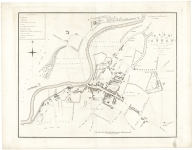
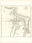
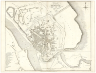
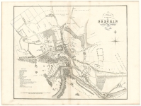
DESCRIPTION: A handsome and very detailed plan of the Scottish town of Inverary on Loch Fyne. Printed by A. Forrester, Edinburgh.<br><br> Below is a portion of the descriptive account of the town from the text volume that accompanied the work:<br><br> <I>Inverary, (in Gaelic, In-ar-aoreidh), is a Royal Burgh in the Parish of that name, and the County Town of Argyleshire. It is 72 miles N. N. East of Campbelltown, 30 south-east of Oban, 60 north west of Glasgow, and 103 miles west by north of Edinburgh. Inverary is situated on a small Bay, near the head of Loch Fyne, where the river Aray, over which there is an elegant stone Bridge of two arches, falls into that arm of the sea. It is a small, but increasing Town, consisting chiefly of one street, and a row of houses facing the Bay, built with great uniformity. The houses are substantial, and all covered with slate. The old Town was, in the 14th century, a small ill-built village, situated on the north side of the Bay, and was removed to its present situation, by His Grace the Duke of Argyle, the greater part has been built by His Grace, who is proprietor of the whole Town. At a short distance from the Town, at the extremity of the bay on the north, stands the Castle of Inverary, the princely residence of the Duke of Argyle.<I><br><br> John Wood, 1780/85 - 1847, was a land surveyor from Edinburgh, Scotland and was elected Permanent Director of the Land Surveyors' Society around 1833. He is best remembered for his exceptionally accomplished 'Town Atlas of Scotland' of 1828 containing forty-eight town plans.<br><br> The publication of this atlas, following ten years of toil, was a conspicuous milestone in the history of urban cartography for it contained the first systematic delineations of many Scottish towns. Plans were accompanied by descriptive and historical accounts of their towns. Curiously, however the atlas omitted some towns which Wood had already surveyed and for which he had published individual plans. Also, not all the delineations are from Wood's own surveys. Individual plans could be purchased in local towns and from the Edinburgh bookseller Thomas Brown.
ADDITIONAL INFO: Printed on "Smith & Alnutt 1827" watermarked paper.
CONDITION: Fair to good condition. Upper right neat line trimmed off due to binding.
REFERENCE:



 Login / Register
 Basket