Price: $295.00
SKU: 105169
ARTIST: Claudius Ptolemy
PUBLISHER: Published by Francois Halma, Amsterdam.
MEDIUM: Engraving.
DATE: 1578 (1730)
EDITION SIZE: Image size 13 3/8 x 18 1/4" (34 x 48.2 cm)
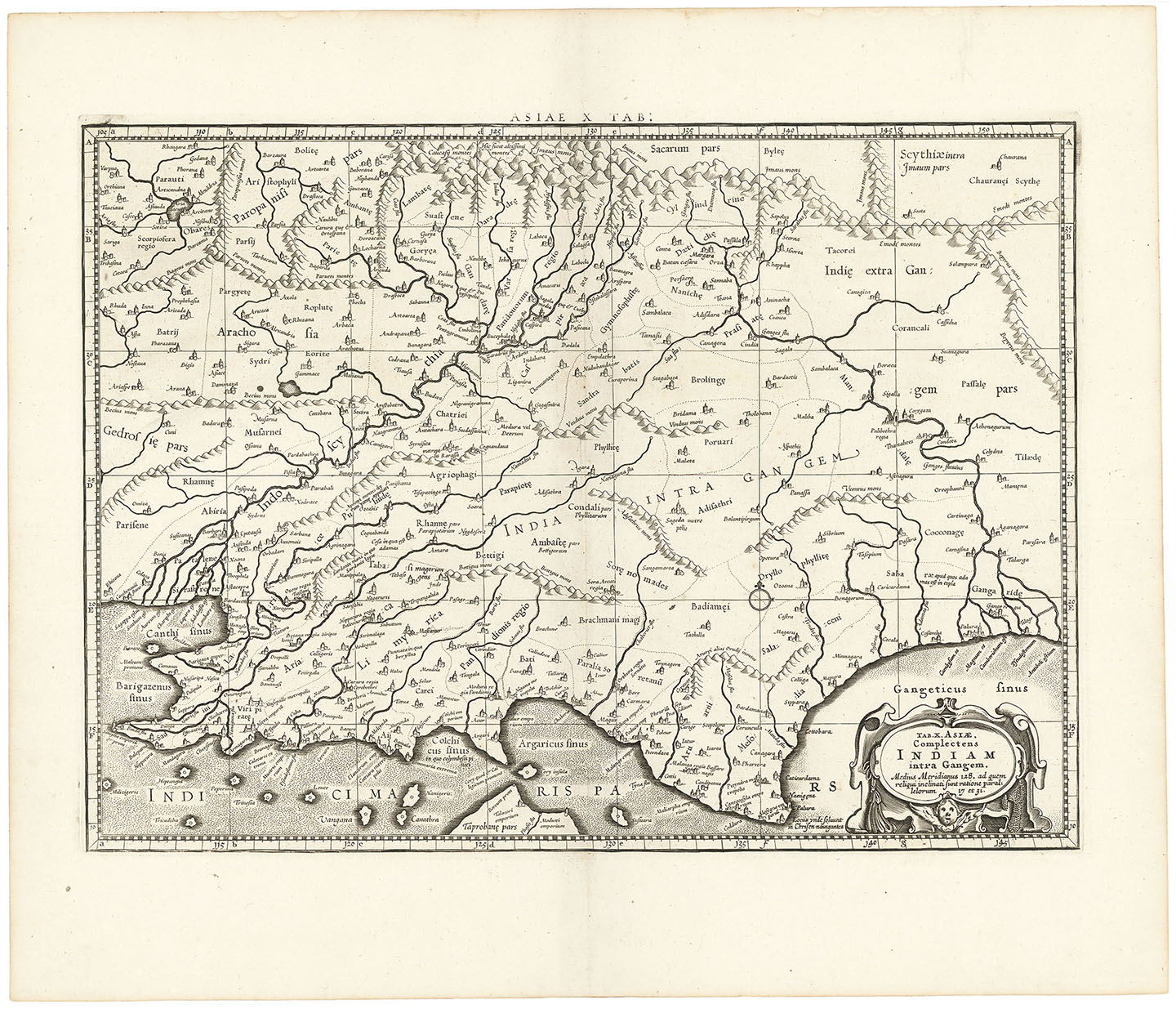
DESCRIPTION: Mercator's Ptolemaic map of India, first issued in the 1578 edition of Mercator's Geographia, based upon the works of Claudius Ptolemy.<br><br> The Himalayan Mountains stretch across the top of the map and the Indus and Ganges river systems are well delineated. The subcontinent is considerably shortened and lacks nearly the entire southern part of India. The northern tip of Taprobana (Sri Lanka) appears at bottom.<br><br> First engraved and published in 1578 and reprinted until 1730.
ADDITIONAL INFO:
CONDITION: Very good condition. B/W
REFERENCE:



 Login / Register
 Basket