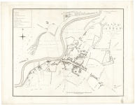
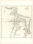
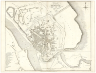
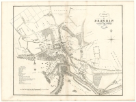
Price: $475.00
SKU: 105215
ARTIST: John Wood
PUBLISHER: Published as the Act directs Sold at Montrose and at No. 1 North Bridge, Edinburgh.
MEDIUM: Engraving.
DATE: 1822
SIZE: Image size 24 1/2 x 19 5/8" (62.2 x 59.9 cm)
DESCRIPTION: A handsome and very detailed plan of the Scottish Port town of Montrose. A lettered key identifies 18 prominent buildings, businesses and public places. Engraved by T. Clerk.<br><br> Below is a portion of the descriptive account of the town from the text volume that accompanied the work:<br><br> <I> Montrose is a Royal Burgh, and Sea-port Town in the County of Angus, or Forfar, seated in a flat sandy peninsula, formed by the German Ocean, the river south Esk, and a large expanse of water, called the Bason. It is 13 miles north of Arbroath, 22 south of Stonehaven, 21 east by north of Forfar, S east of Brechin, and 94 miles from Edinburgh, on the great northern road.<br> The Town is neatly built, consisting of a fine spacious main street, with other streets diverging from it. The houses, though not elegant, are in general well built and regular. Many houses in the south end, or old part of the Town, have their gables to the street, in the Flemish style, but the new erections in the streets lately laid out, are in a higher degree of elegance and taste.<br> Montrose has been long distinguished for the excellence of its Academy and public Schools, where every branch of liberal education is taught, in a manner not inferior to any part of the kingdom.</I><br><br> John Wood, 1780/85 - 1847, was a land surveyor from Edinburgh, Scotland and was elected Permanent Director of the Land Surveyors' Society around 1833. He is best remembered for his exceptionally accomplished 'Town Atlas of Scotland' of 1828 containing forty-eight town plans.<br><br> The publication of this atlas, following ten years of toil, was a conspicuous milestone in the history of urban cartography for it contained the first systematic delineations of many Scottish towns. Plans were accompanied by descriptive and historical accounts of their towns. Curiously, however the atlas omitted some towns which Wood had already surveyed and for which he had published individual plans. Also, not all the delineations are from Wood's own surveys. Individual plans could be purchased in local towns and from the Edinburgh bookseller Thomas Brown.<br><br>
ADDITIONAL INFO: Printed on "Smith & Alnutt 1827" watermarked paper.
CONDITION: Good condition
REFERENCE:



 Login / Register
 Basket