Price: $475.00
SKU: 105231
ARTIST: Frederick de Wit
PUBLISHER: Published by Covens and Mortier
MEDIUM: Engraving,
DATE: 1690, c.1710.
EDITION SIZE: Image size 16 1/4 x 20 1/4" (41.3 x 51.3 cm)
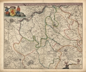
DESCRIPTION: Shown on this map is an area of current day Northern India and Pakistan. Including Ganges, Bengal, Delhi, Lahor, Napal, Cashmere, Kabul and Tibet.<br><br> Extends south to include a large portion of India, including Orixa, Cambaya, Decan, etc.<br><br> Embellished with galleon under sail, elephants, and camels. First issued in 1690 by De Wit, plates acquired and reissued by Covers and Mortier.
ADDITIONAL INFO:
CONDITION: Good condition save for overall paper toning. Tiny hole in center right due to verdigris. Original hand coloring.
REFERENCE:



 Login / Register
 Basket