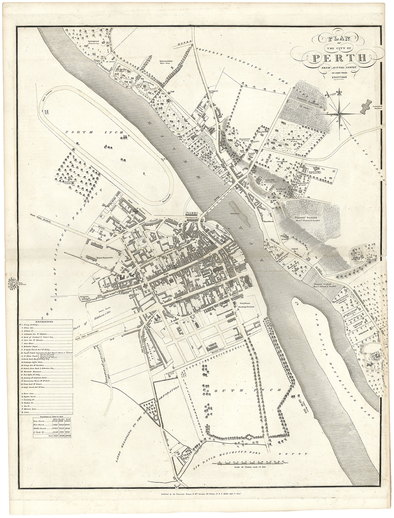
Price: $475.00
SKU: 105233
ARTIST: John Wood
PUBLISHER: Published by the Proprietor Canaan & Wm. Swinton 60 Princes St. & J. Richie High St. Edinburgh.
MEDIUM: Engraving
DATE: 1823
SIZE: Image size 25 3/8 x 20" (64.4 x 50.8 cm)
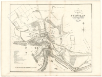
DESCRIPTION: A handsome and very detailed plan of the Scottish town of Perth. A numbered and lettered key identifies 28 prominent buildings, businesses and public places. Engraved by T. Clerk.<br><br> Below is a portion of the descriptive account of the town from the text volume that accompanied the work:<br><br> <I> Perth, or St Johnston's, is a large and very ancient Royal Burgh, the capital of Perthshire, and the ancient capital of Scotland. It is situated on the west bank of the Tay, at the opening of an extensive plain, surrounded in the vicinity by the most picturesque hills, to the south and west, and having in the distance to the north, a view of the sublime amphitheatre of the Grampians. It is 43 1/4 miles north of Edinburgh, by Queensferry, 21 3/4 miles west by south of Dundee, 61 miles north by east of Glasgow, and 15 miles south of Dunkeld.<br> Perth is more regularly built than any old Town in Scotland, it has four principal Streets, running east and west, Mill Street, High Street, South Street, and Canal Street.<br> The City of Perth is regularly and substantially built, the principal Streets are broad, well paved, cleaned, and lighted with Gas. The public buildings are all handsome, and many of them possess a high degree of architectural ornament.</I><br><br> John Wood, 1780/85 - 1847, was a land surveyor from Edinburgh, Scotland and was elected Permanent Director of the Land Surveyors' Society around 1833. He is best remembered for his exceptionally accomplished 'Town Atlas of Scotland' of 1828 containing forty-eight town plans.<br><br> The publication of this atlas, following ten years of toil, was a conspicuous milestone in the history of urban cartography for it contained the first systematic delineations of many Scottish towns. Plans were accompanied by descriptive and historical accounts of their towns. Curiously, however the atlas omitted some towns which Wood had already surveyed and for which he had published individual plans. Also, not all the delineations are from Wood's own surveys. Individual plans could be purchased in local towns and from the Edinburgh bookseller Thomas Brown.<br><br>
ADDITIONAL INFO: Printed on "Smith & Alnutt 1827" watermarked paper.
CONDITION: Good condition. narrow right margin due to binding.
REFERENCE:



 Login / Register
 Basket