Price: $2,000.00
SKU: 26004
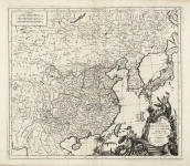
ARTIST: Francois Santini
PUBLISHER: Published by Giueseppe Remondini, Venice.
MEDIUM: Copper plate engraving,
DATE: 1784.
EDITION SIZE: Image 15 1/8 x 25 1/8" (38.4 x 65.1 cm) plus lower text and margins.
DESCRIPTION: A handsome and well-engraved world map constructed with the prime meridian through Paris. The hemispheres are rotated through 45 degrees. This is an unusual projection for a world map and was based on the work of the French Academie Royale des Sciences. This particular impression is by Remondini who reissued Santini’s “Atlas Univ.” in 1784.
ADDITIONAL INFO:
CONDITION: Good condition, save for some small marginal repairs. Attractive modern hand-coloring.
REFERENCE:


 Login / Register
 Basket