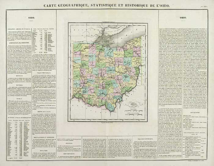
ARTIST: Jean Buchon
PUBLISHER: Published by J. Buchon, Paris.
MEDIUM: Hand colored copper plate engraving,
DATE: 1825
EDITION SIZE: Image size 17 3/4 x 23 3/4" (452 x 602 mm) including text.
DESCRIPTION: This fine early map is from a French produced version of the Carey & Lea atlas, "A Complete Historical, Chronicle, and Geographical American Atlas." The descriptive text describes the history, rivers, climate government, etc.
ADDITIONAL INFO:
CONDITION: Good condition. Original hand coloring.
REFERENCE:


 Login / Register
 Basket