Price: $27,500.00
SKU: 29480
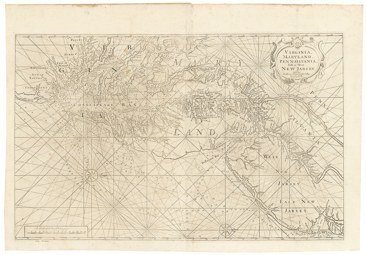
ARTIST: John Thornton
PUBLISHER: Published in "The English Pilot, The Fourth Book" and "Atlas Maritimus."
MEDIUM: Copper plate engraving,
DATE: c.1687.
EDITION SIZE: Image size 16 1/2 x 20 1/8" (42 x 51 cm).
DESCRIPTION: The first printed map to depict Long Island accurately. It took European explorers and colonists more than 200 years to determine the correct shape of the island. The earliest maps, based on the voyages of Verazzano, depict Long Island as a peninsula named Flora. In 1614, Adriaen Block was the first to show it correctly as an island. In later years different cartographers depicted Long Island in many shapes and sizes, even an archipelago. An exact source for this map was not given by Thornton. It has been suggested that this map was loosely based on the manuscript chart by Robert Ryder made in 1674. Recent research suggests that Phillip Wells, who was Surveyor General of the Colony of New York in 1683, may likely have had a hand in it. On the northern shore of Staten Island is the name "Wells," the home of Phillip Wells. Wells is known to have surveyed the boundary between New York and Connecticut. This map appeared in early editions of "The English Pilot, The Fourth Book" published by John Thornton and William Fisher (1689-1713) and in the "Atlas Maritimus" (1704 and 1708). There are two states of this map with this being the first. The second state has additional engraved soundings east of "Renslows Hill" in New Jersey. It is rare in either state.
ADDITIONAL INFO: This particular impression was cut to the neatline and mounted on heavier paper. It was likely done at the time of binding by Thornton for use in a working sea atlas or pilot. This made the chart far more durable for use aboard a ship. Many early English Sea atlases were often composite in make-up, as they were assembled according to the wish of the individual purchaser, rather than to a standard format.
CONDITION: Good condition, save for faint old mat line. Original outline hand coloring.
REFERENCE: Burden, "North America II" #636; McCorkle "New England" #689.7; Map Forum.com, Issue 2 "Charting of New England" by Ashley Baynton-Williams.


 Login / Register
 Basket