Price: $75.00
SKU: 34395
PUBLISHER: Published by Rand, McNally & Co.
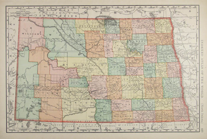
MEDIUM: Multi-color roto-lithograph.
DATE: 1898
EDITION SIZE: 19 x 12 1/2" (482 x 318 mm) plus margins.
DESCRIPTION: A detailed map from the “Rand McNally & Company’s Indexed Atlas of the World”, featuring counties, mountains, rivers, township lines, railroads and railway stations, and other details.
ADDITIONAL INFO:
CONDITION: Good condition and color.
REFERENCE:



 Login / Register
 Basket