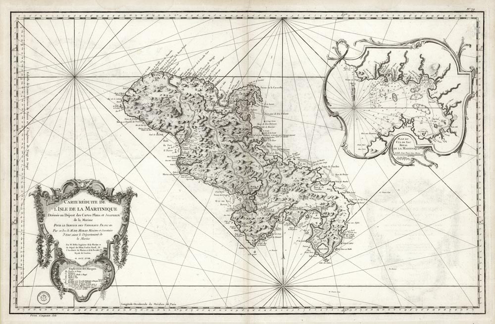
ARTIST: Jacques Bellin
PUBLISHER: Published by the Depot de la Marine, Paris.
MEDIUM: Copper plate engraving,
DATE: 1758
EDITION SIZE: 21 3/4 x 33 5/8" (572 x 853 mm) plus margins.
DESCRIPTION: This handsome large scale chart shows tarishes, towns, plantations, windmills, roads anhorages and a few soundings. The inset shows a close up of the town and harbor of "Cul de Sac Royal." This chart was issued in "Neptune americo-septentrionale" by Depot General de la Marine, the official French Government agency of nautical charts. An accomplished work both as a sea chart and topographic work. A nice strong impression.
ADDITIONAL INFO:
CONDITION: Good condition. Black & white.
REFERENCE: Sellers & Van Ee #2045.


 Login / Register
 Basket