Price: $625.00
SKU: 3476
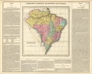
ARTIST: Fielding Lucas, Jr.
PUBLISHER: Published by H. C. Carey and I. Lea, Philadelphia.
MEDIUM: Handcolored engraving,
DATE: 1822, c.1823.
EDITION SIZE: 16 5/8 x 20 3/4" (422 x 526 mm) plus margins.
DESCRIPTION: Published for "American Atlas." Florida was a brand new United States territory when this map was published. St. Augustine was the chief town. The first governor, Andrew Jackson, oversaw the removal of the Seminoles in 1818 and in 1819 the western part of the state was purchased from Spain for $5,000,000.
ADDITIONAL INFO:
CONDITION: Good condition. Original hand coloring
REFERENCE:


 Login / Register
 Basket


![Geographical, Statistical, and Historical Map of the United Provinces of South America. [Argentina]](https://oldprintshop.com/uploads/2025/10/23531.jpg)