Price: $1,600.00
SKU: 39926
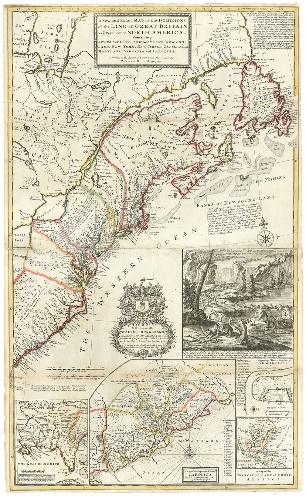
ARTIST: Hermann Moll
PUBLISHER: Printed for H. Moll over against Devereux Court near Temple Bar. J. Bowles Print and Map Seller... T. Bowles... And by P. Overton.
MEDIUM: Copper plate engraving
DATE: c.1730.
EDITION SIZE: 22 5/8 x 38" (575 x 965 mm) plus margins.
DESCRIPTION: This handsome map is dedicated to the Right Honourable, Charles Earl of Sunderland, and Baron Spencer or Wormleighton. This dedication is within an elaborate cartouche that was designed by Bernard Lens. It depicts native Indians, a large waterfall, and two erupting volcanoes. In the foreground are bars of gold and or other precious metals. In the opposite corner is an inset view of Potosi with a note about the mining operations there. Off Chile, in the Pacific Ocean, are delineated the Juan Fernandez Islands. Moll notes that Alexander Selkirk was marooned for four years and four months. Selkirk's odyssey was the inspiration for Daniel Defoe's grand literary work "Robinson Crusoe." In the Atlantic, to the right of Patagonia is a note whereupon Molls rails against his competitors. "The world is an nothing more scandalously imposed upon than by maps put out by ignorant Pretenders, who most falsely and impudently assume ye titles of ye Queen's Geographers...and to deceive mankind have dedicated [these maps] to Dr. Halley..." Engraved by George Virtue.
ADDITIONAL INFO:
CONDITION: Good condition save for some minor repaired splitting along folds. Soft original outline hand coloring.
REFERENCE:


 Login / Register
 Basket