Price: $300.00
SKU: 42822
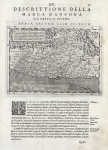
ARTIST: Claudius Ptolemy
PUBLISHER: Published by Leinhart Holle, Ulm.
MEDIUM: Woodcut. (Digital printing)
DATE: 1482. (2006)
EDITION SIZE: 16 x 22" (406 x 560 mm) plus margins
DESCRIPTION: A fine quality reproduction of the rare first state of the Ulm Ptolemy map of the world, one of the most famous and highly sought after of all 15th-century world maps and certainly the most decorative.. It is the first map of the world printed North of the Alps and the first to appear in color which was applied by the publisher. It is also the earliest world map signed by its engraver, Johanne Schnitzer. While Ptolemaic in construction, the map includes information in Scandinavia based upon Claudius Clavius's map of 1427. The map follows the manuscript map of Donnus Nicolaus Germanus issued in the prior decades. The Ulm Ptolemy was first published in 1482 by Leinhart Holle. However, Holle went bankrupt shortly after the original publication and the work was taken over by Johann Reger, who issued an addition in 1486. While the map does reflect some modern updates, the Portugese discoveries in Africa are omitted and the map retains a closed Indian Ocean with a land bridge or unknown Southern Continent connecting Asia and Africa. Twelve windheads ring the map, each of which is named.
ADDITIONAL INFO: A fine digital reproductive print made after the original hand colored impression. This print has been produced by the Digital Archive, Ltd.
CONDITION: Fine condition.
REFERENCE: Shirley, R. "The Mapping of the World" #10.


 Login / Register
 Basket