Price: $1,650.00
SKU: 45271
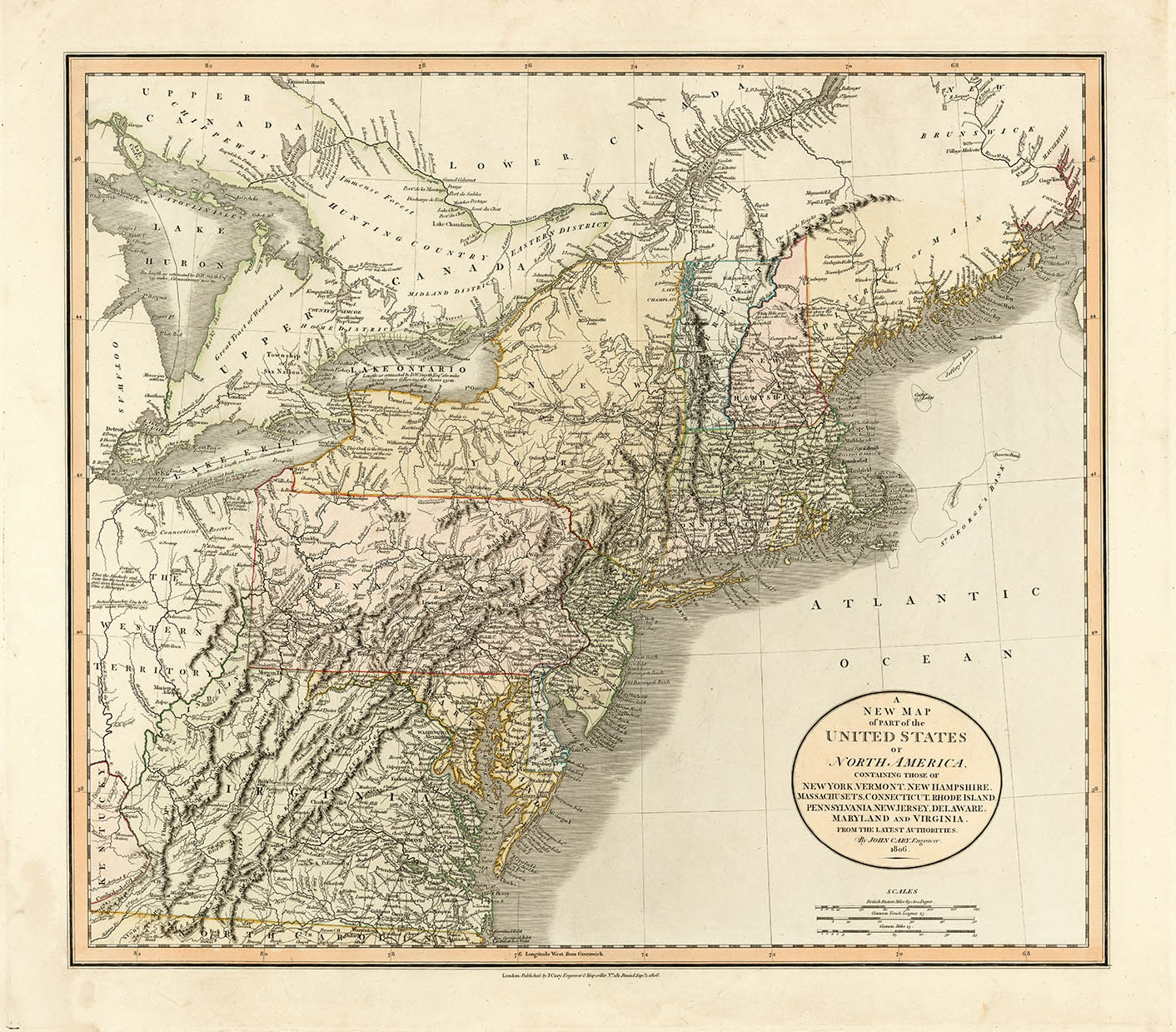
ARTIST: John Cary
PUBLISHER: Published by G. & J. Cary, No 86 St. James Street
MEDIUM: Copperplate engraving,
DATE: 1846
EDITION SIZE: Segmented case map, 35 3/4 x 33" (907 x 840 mm)
DESCRIPTION: An unusual and quite scarce separately issued map of the Americas. This map delineates all the countries in Western Hemisphere, each outlined with outline hand coloring. Mexico is shown at its largest extent with its pre Mexican-American War (1846-1848) boundaries (which include all of present day California, Nevada, Colorado, New Mexico & Arizona) I found a reference that noted that this map was first issued by John Cary in 1819. This example is noted as being published by the firm of G. & J. Cary, which consisted of John Cary the elder, John Cary the younger and George Cary. What is unusual about this is that there are several reference works noting that firm’s printing plates were sold c.1844 to G. F. Cruchley. It is possible that this transfer to Cruchley took a few years to complete or, it is also possible the due to the impending war, Cruchley quickly published the map without revisions.
ADDITIONAL INFO: This example is ex. Chicago Historical Society. It bears their ink stamp and catalog number just below the cartouche.
CONDITION: Good condition. Original hand coloring. Lacks slip case.
REFERENCE:


 Login / Register
 Basket