Price: $295.00
SKU: 48608
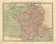
ARTIST: John Luffman
PUBLISHER: Published by Barney & Gold, London.
MEDIUM: Copper engraving,
DATE: 1799.
EDITION SIZE: 14 1/2 x 11 1/8" (362 x 283mm).
DESCRIPTION: From The Naval Chronicle." With a list of the Dutch vessels surrendered to the English, the British line of battle and a legend about Gen. Ralph Abercrombie’s landing.
ADDITIONAL INFO:
CONDITION: Good condition save remargining on left. Black and white.
REFERENCE:


 Login / Register
 Basket