Price: $2,750.00
SKU: 49484
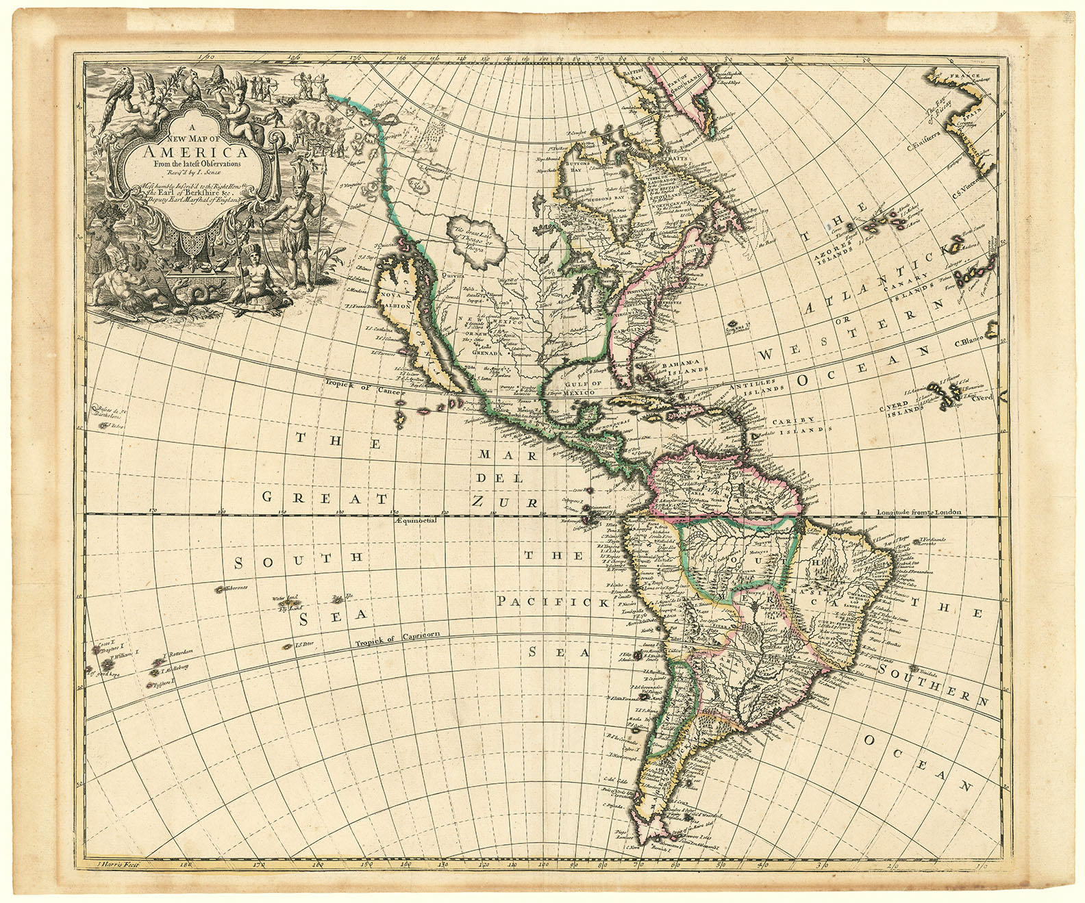
ARTIST: John Senex
MEDIUM: Copper plate engraving,
DATE: circa 1721.
EDITION SIZE: Image size 19 1/4 x 22 5/8" (48.2 x 57.5 cm)
DESCRIPTION: The Mississippi Bubble map. The First English Map of French Louisiana and the Mississippi Valley.<br><br> "This is 'a most impudent plagiarism' from de L'Isle, for it is closely based on his 1718 map" - Wm Cumming. As noted, this attractive map is largely pirated from Guillaume de L'Isle's ca.1718 "Carte de la Louisiane et du Cours du Mississipi," which is one of the great "mother" maps for cartography of the Gulf coast. shown on this map are the routes taken by the explorers Hernando de Soto, Alonso de Leon, St. Dennis and la Salle. Also shown are a great many Indian villages, tribal names, forts and rivers. One interesting legend is found along the Gulf coast of current-day Texas: "Wandering Indians & Man-eaters." Strangely, Senex continued to depict the English colonies from the French viewpoint by delineating their western boundary lines at the eastern range of the Appalachians rather than at the Mississippi River. In current day northern Ohio is a note “Nation du Chat – It was destroyed by ye Iroquois” <br><br> Senex dedicated this map to William Law, the father of financier-speculator John Law, whose scheme to develop French Louisiana, later known as the Mississippi Bubble, eventually caused the financial ruin of many European investors.
ADDITIONAL INFO: Nicely framed in a receding black & sanded spandrel molding. Overall framed size. 24 x 27 5/8"
CONDITION: Good condition. Original outline color. Large repaired tear in upper right quarter of the map.
REFERENCE: Cumming, W. "Southeast" #182; Lemmon "Charting Louisiana" #21.


 Login / Register
 Basket