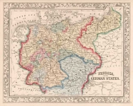
ARTIST: Samuel Augustus Mitchell
PUBLISHER: Published by S. Augustus Mitchell, Philadelphia.
MEDIUM: Lithograph, hand colored,
DATE: 1879
EDITION SIZE: Image size 14 1/4 x 11 3/4" (36.2 x 29.9 cm).
DESCRIPTION: An interesting early map of the Dakotas shown in its 1868-82 configuration before the division into two separate states. Depicted are counties, railroads, forts, land agencies, Indian reservations, buttes, rivers, lakes, and other details. This map appeared in Mitchell's "New General Atlas." With grape-vine border.
ADDITIONAL INFO:
CONDITION: Fair condition. Trimmed into grape vine border on left edge. Original color.
REFERENCE:


 Login / Register
 Basket