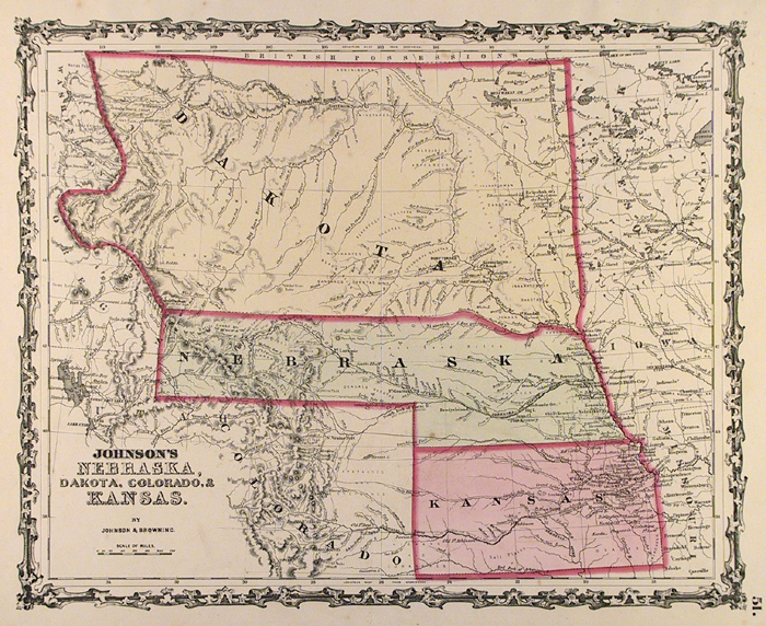
ARTIST: A. Johnson
PUBLISHER: Published by Johnson and Browning. New York.
MEDIUM: Engraving handcolored,
DATE: c. 1862.
EDITION SIZE: Image size 12 3/8 x 15 1/2" (31.5 x 39.1 cm).
DESCRIPTION: Map 51 from Johnson's "American Atlas". Both Dakota and Nebraska Territories stretch westward into the Rocky Mountains. Montana and Wyoming Territories do not yet exist. Many forst are marked along the Platte and Missouri Rivers.
ADDITIONAL INFO:
CONDITION: Good condition with original color save waterstain on outer 1/8" of right margin.
REFERENCE:


 Login / Register
 Basket