Price: $525.00
SKU: 53897
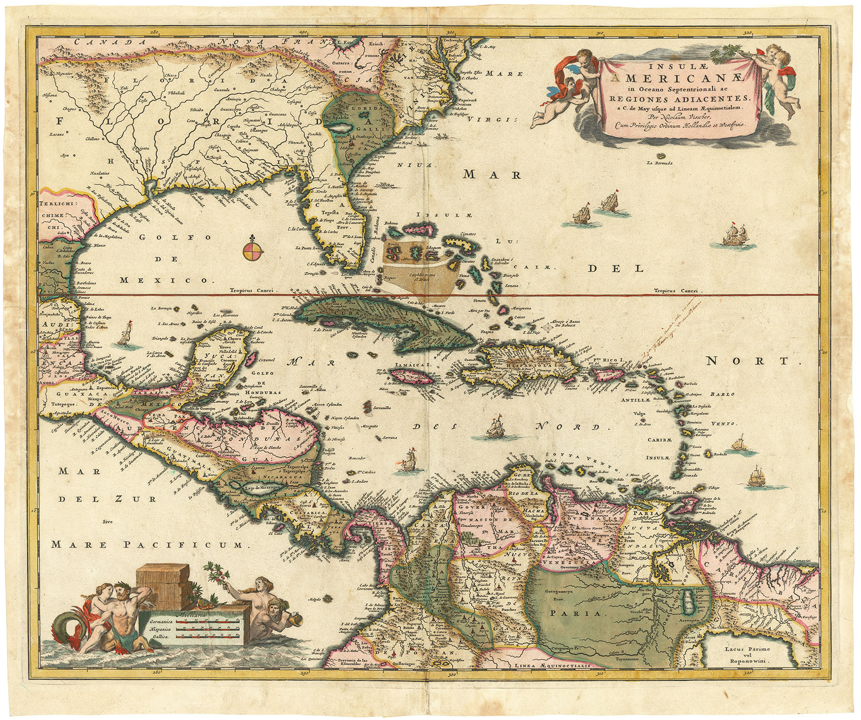
ARTIST: Nicolaes Visscher
PUBLISHER: Published by Nicolas Visscher, Amsterdam.
MEDIUM: Copper engraving, original hand color,
DATE: c. 1660.
EDITION SIZE: Image size 18 1/16 x 21 7/8" (45.9 x 55.4 cm).
DESCRIPTION: A superb map of the VII provinces that make up the Belgian federation. Shows an area from Flanders and Brabant across Holland to Frisia. With a small inset of the area around Maastricht.
ADDITIONAL INFO:
CONDITION: Good condition save for rejoined centerfold. Period hand coloring.
REFERENCE:


 Login / Register
 Basket