Price: $3,500.00
SKU: 51744
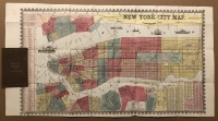
ARTIST: Humphrey Phelps
PUBLISHER: Published by H. Phelps, No. 144 Fulton Street, near Broadway, New York.
MEDIUM: Wood engraving,
DATE: 1846 -1847.
EDITION SIZE: Sheet size, 28 5/8 x 21 3/16" (72.8 x 53.8 cm).
DESCRIPTION: A decorative broadside map produced during the Mexican-American War. The map shows the entire U.S. and Mexico with a separately colored Texas, Mexico, Oregon and California. It delineates the proposed transcontinental railroad. Along the upper quarter are three portraits, Cortez, George Washington and Montezuma. Along the lower quarter are portraits of Mexican General Santa Anna and American General Zachary Taylor. Surrounding the lower portraits is descriptive and statistical information on the U.S., Mexico, Oregon, and California. Also includes images of seals of the U.S. and Mexico as well as the Great Temple to the Sun that was destroyed by Cortez in 1521.
ADDITIONAL INFO:
CONDITION: Good condition save for a tear in the lower central portion of the map which has been professionally repaired. Backed on rice paper. Original hand coloring.
REFERENCE:


 Login / Register
 Basket